|
| BURIED SCULPTURE |
|
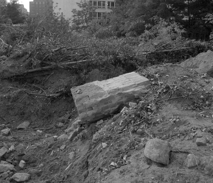
2010 “Since we overcame the error of supposing that the forgetting we are familiar with signified a destruction of the memory-trace—that is, its annihilation—we have been inclined to take the opposite view, that in mental life nothing which has once been formed can perish—that everything is somehow preserved and that in suitable circumstances (when for instance, regression goes back far enough) it can once more be brought to light.” Freud, Civilization and its Discontents A sculpture is to be cast in concrete from a concealed, underground cavity or void; the cavity is situated among and is formed by the remnants of former man-made structures or existing natural features embedded within the site. The cavity might be oblong or rotund, architectonic or organic in shape, as large as a room or as small as a cubic meter. The cavity is to be located using common geophysical techniques (known as GPR or ground penetrating radar), a non-invasive way of imaging and mapping subterranean features. Once a suitable cavity is found, it is to be cast in concrete and the resulting positive form—the solidified sculpture—unearthed and displayed on site, adjacent to the opening in the ground from which it is cast and excavated. The work consists of the sculpture, an artist’s book featuring documentary photographs of the surveying, casting, and unearthing process, the geo-physical maps of the site, site models, as well as historical maps and aerial photographs of the area from local archives. |
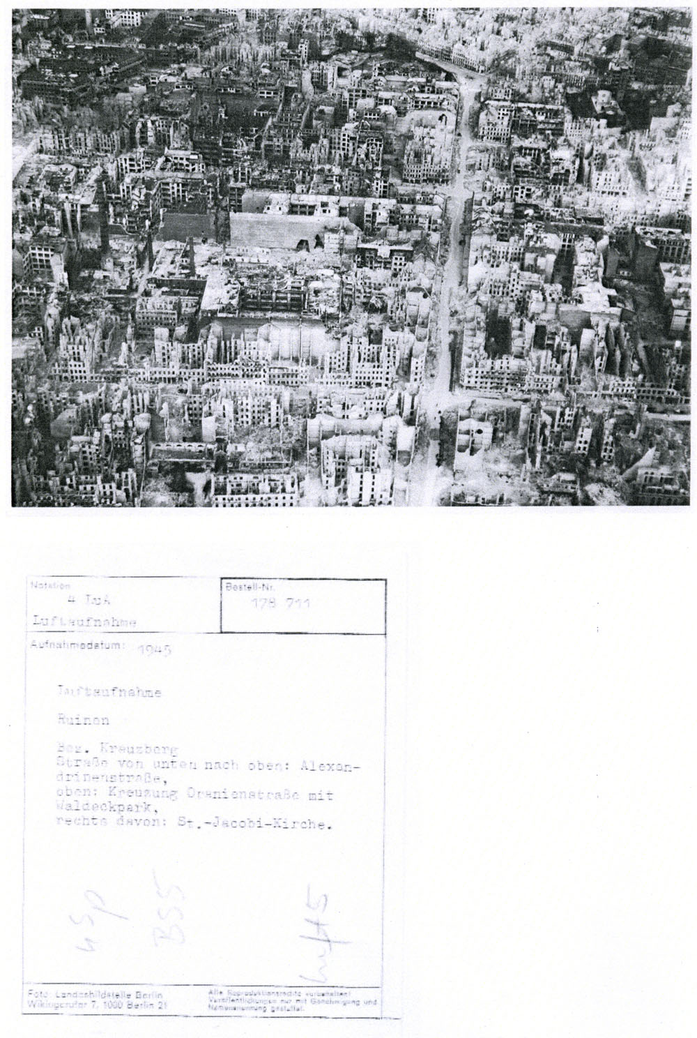
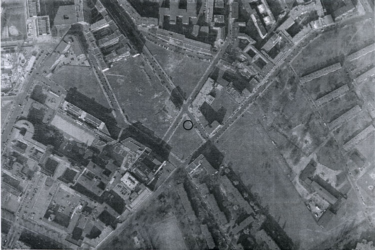
| The proposed site is located in Berlin-Kreuzberg, across from the Bundesdruckerei, between Alte Jakobstraße, Kommandantenstraße, and Seydelstraße. Once part of the path of the Berlin Wall, the site currently lies vacant and is subject to real estate speculation. For over half a millenium it has been a zone of urban transition. Situated at the beginning of the fifteeth-century just outside the defensive walls of the old settlements of Alt-Berlin and Cölln, during the Industrial era it lay wedged between the historical Friedrichstadt and Luisenstadt districts. Over the last century in particular, the area has undergone drastic changes: from the cosmopolitan buildings that lined its streets in the late 1900s to their destruction in WWII; and from the construction of the Berlin Wall in 1961 to its dismantling in 1989. Since that time it has been used as a parking lot, a make-shift park for local residents and their dogs, and as the location for temporary art interventions organized by Skulpturenpark Beriln_Zentrum. |
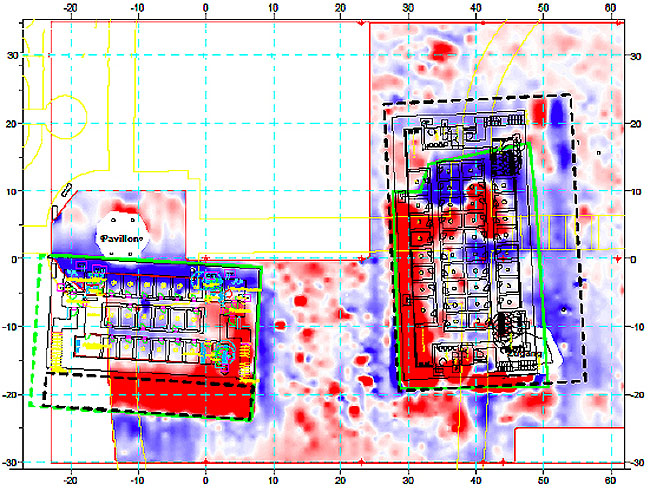
| Geo-physical survey map (Berlin-Gesundbrunnen); colors depict different material densities indicating exact positions of subterranean structures and potential cavities suitable for casting. Image: Büro für Geophyzik Lorenz, Berlin. |
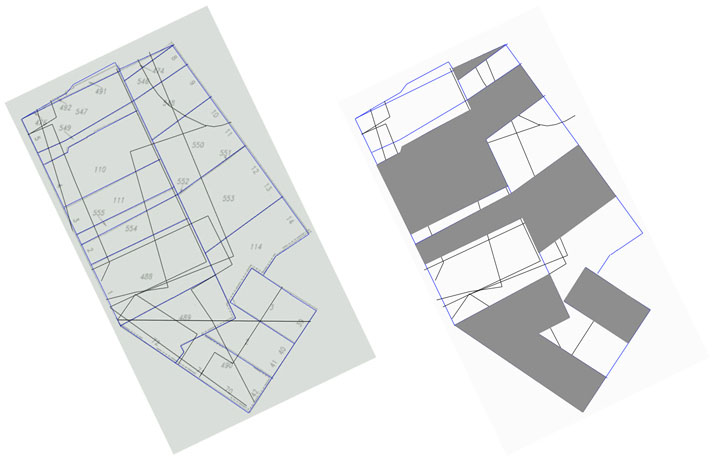
| Model graphic (left image) site map showing current zoning divisions (blue lines) and historical zoning divisions (black lines); site map (right image) grayed sections indicate the top layer of the model and current zoning divisions, lighter sections indicate the inset layer of the model and historical zoning divisions. Actual zoning maps dating from 1690, 1750, 1800, 1850, 1910, and 1940 were used to create the model. |